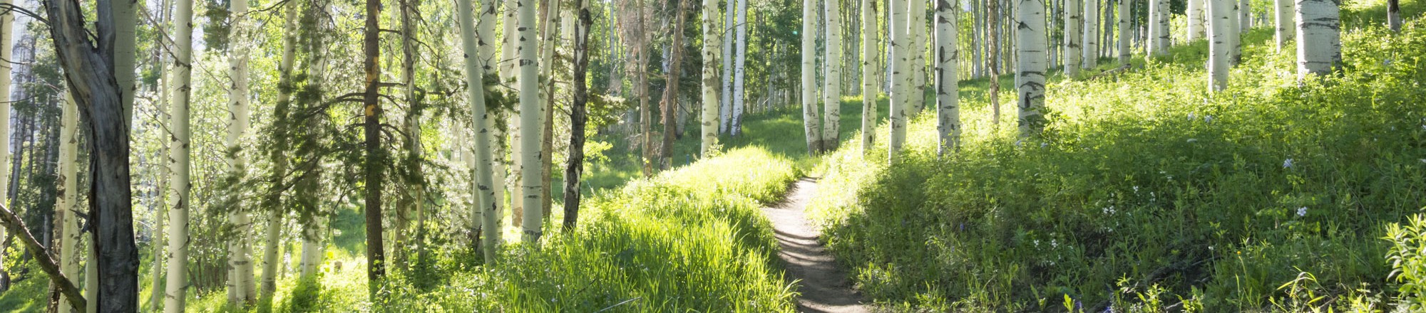
Hiking
Take in the majestical surroundings, peaceful silence, and challenge yourself to explore the hiking trails in the roaring fork Valley. The reward of standing atop the hills and mountains that you ascend is one of rejuvenation and connection with nature. So unplug, get your most comfortable shoes on, take a water bottle and sunscreen and go hiking. Here are 3 great hikes in basalt. Submitted by: Todd Hartley
Basalt High School Trail: As its name suggests, this hike starts directly behind Basalt High School and heads west along a gentle trail before climbing steeply to reach a ridge near the top of Light Hill. From the main Basalt stoplight on Highway 82, go south on Basalt Avenue (away from downtown). Take a right onto Fiou Lane and then go left on Southside Drive to where it ends at the high school. Behind and to the left of the school there is a bus turnaround. The trail begins at the left side of the turnaround.
Follow the trail as it snakes along a lower bench of Light Hill. After about a mile, look for a steep, rutted dirt road heading up to your left. Hike along the road to where it reaches the top of the ridge, and you will be rewarded with an awe-inspiring view of Mount Sopris and the Basalt area. This makes a logical stopping point, but if you choose to go on, the road (which is essentially impassable to cars) goes east all the way to Old Snowmass.
Arbaney Kittle Trail: Obviously, this is not exactly a hidden gem, being far and away the most popular hike in Basalt. But if you know where you’re going, it’s possible to avoid the crowds by taking a steep, wild track that climbs a hill just to the west before linking up with the main trail. From Highway 82 south of downtown Basalt, go north on Bishop Road. Take a left onto Holland Hills Road and then stay straight on Kelly Court as it turns to dirt and ends at the trailhead parking lot. At the north end of the lot look for the “No Motorized Vehicles” sign that marks the start of the alternate route.
The trail climbs very steeply north away from the parking lot and follows a broad ridge. At times the trail can be hard to find. Make sure to stay on the ridge all the way to the top, where it intersects another ridge running east to west. Find a trail heading east and follow it to where it connects with the main trail. The views of the Elk Mountains and the Frying Pan Valley from this vantage point are top-notch.
A word of warning: This hike is very steep and involves some tricky route-finding. If you are not an experienced hiker, it is strongly recommended that you stay on the main trail.
Seven Castles: This is one of the most unique and dramatic hikes in the entire Roaring Fork Valley, winding its way up a sandstone canyon, past numerous waterfalls and up to a vast amphitheater of towering cliffs and interesting red rock formations. However, due to the fragile nature of the area and the very real dangers of the hike itself, no directions will be offered to the trailhead. Ask around a little, though, and you should be able to find someone who can direct you there.
Once you’ve found the trail, follow it east a short distance to where it drops down to Seven Castles Creek. From here, the creekbed is the trail. Go north between the looming sandstone cliffs to reach a beautiful waterfall. There are ropes hanging down the cliffs to the left. Use these to climb up past the falls and continue on your way. Soon you will come to a second waterfall in a narrow box canyon. From here the trail climbs sharply up the hill to the left before traversing around the top of the falls and back to the creekbed. There is a third large waterfall that is easy to miss and, beyond that, a delicate double waterfall. Climb up between the two cascades to reach a rocky spire overlooking a magnificent sandstone wilderness. It is possible to continue on from this point, but it’s quite dangerous and strongly discouraged for even the most experienced hikers.